
Mining
Satellite imagery for mining
Disturbance and rehabilitation records that line up year on year, plus stockpile volumes and ground movement.
100+ satellites · delivered to 72 countries · per-km² prices published
Closure reporting, wherever you operate
Regulators want disturbance and rehabilitation measured on a date, and measured the same way the next year.
- Disturbed area, on a date
- A capture near your reporting date, and a boundary around the disturbance.
- Rehabilitation, against the plan
- Imagery of each landform when its earthworks finish, then a vegetation index as cover returns.
- A record you did not make
- Captured by a satellite, dated at capture, and processed the same way every year.
Worked example: Western Australia and Queensland
Scheme
The rule
What you report
What we supply
Western Australia
Mining Rehabilitation Fund
1%
of your Rehabilitation Liability Estimate, levied each year
Disturbed hectares in each category. You measure them; the department audits a sample of returns.
A dated capture near your assessment date, and a boundary around finished earthworks.
Queensland
Progressive Rehabilitation and Closure Plan
Nov 2019
since when site-specific mines hold a plan with enforceable milestones
Each rehabilitation milestone in the plan, met on its date.
Imagery of each landform when its earthworks finish, then a vegetation index as cover returns.
How the two schemes work
Western Australia: the Rehabilitation Liability Estimate is your disturbed hectares multiplied by a rate set between A$2,000 and A$50,000 a hectare. Land whose closure earthworks are finished drops to the A$2,000 rate, and a dated boundary around it is how you show it qualifies.
Queensland: since November 2019, site-specific mines have held a plan that schedules rehabilitation milestones across the life of the mine. The milestones are enforceable, so missing one is a compliance problem now, decades before closure.
In December 2022 the WA Auditor General recommended checking self-reported disturbance figures against independent sources.
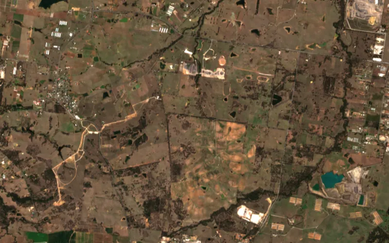
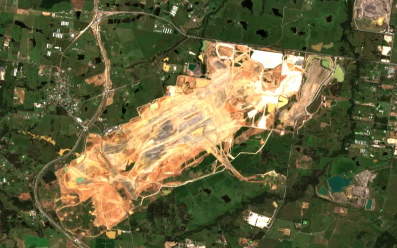
Each year lines up with the last
Every order is aligned to your earlier dates, typically within a pixel.
An analyst signs off the alignment report before delivery. File it with your return.
orthorectified · aligned · cloud masked · colour balanced
Cloud cover and mapping detail
Where cloud covered part of a tenement on the day, the mask shows which part. Record it as not observed. Counting it as undisturbed is how a return goes wrong.
Before a figure goes on a return, check the sensor's minimum mapping width and positional accuracy.
What to order
- The whole footprint
- Sentinel-2 at 10 m, free in Pera Portal. Maps areas down to about half a hectare.
- Exact boundaries
- Sub-metre archive or a new capture. Traces features of about a tenth of a hectare.
- Years nobody captured
- Archive imagery by date, so the record can start before the earthworks.
- Heights and volumes
- A stereo order, with surface and terrain models built from the same images.
If you hold survey control or drone surveys of the site, send them with the order and we'll tie the satellite record to them.
One stereo order 01 / 04
30 cm · what the satellite saw
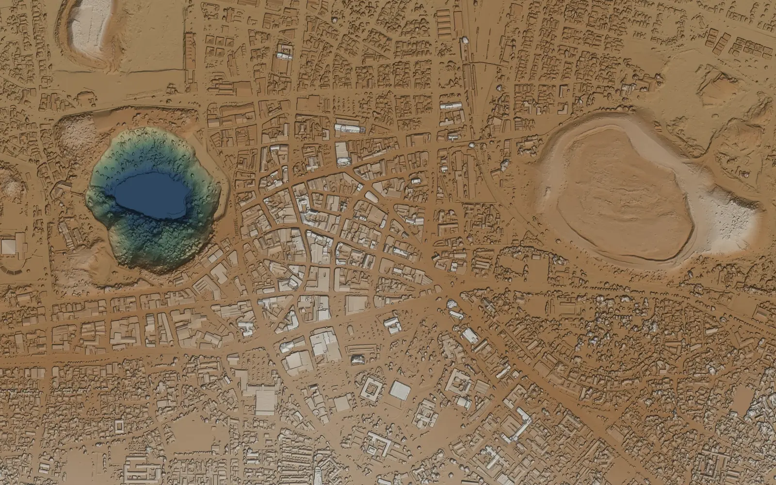
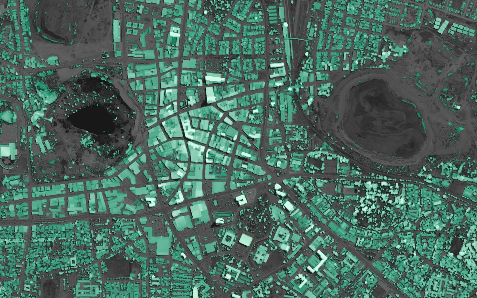
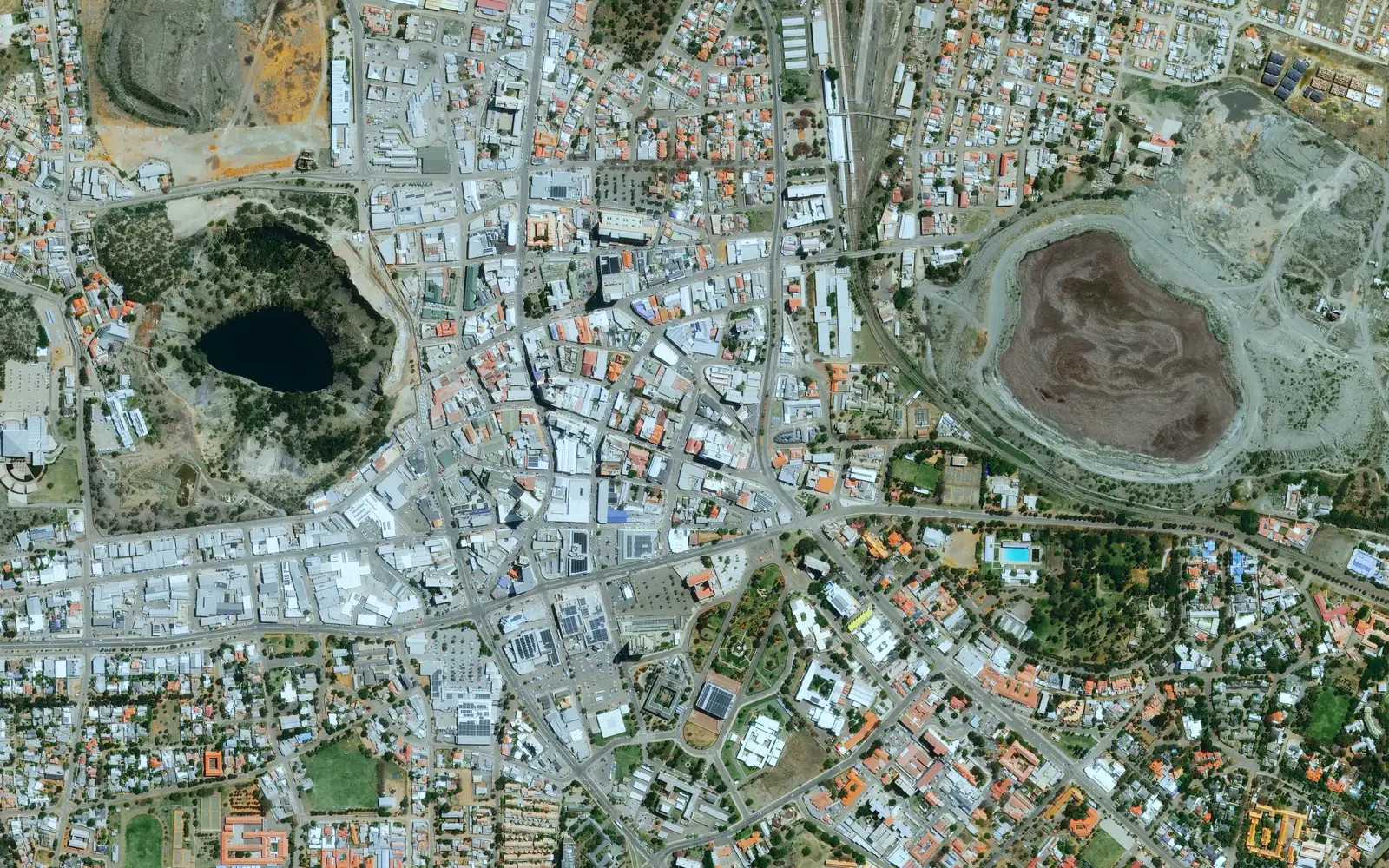
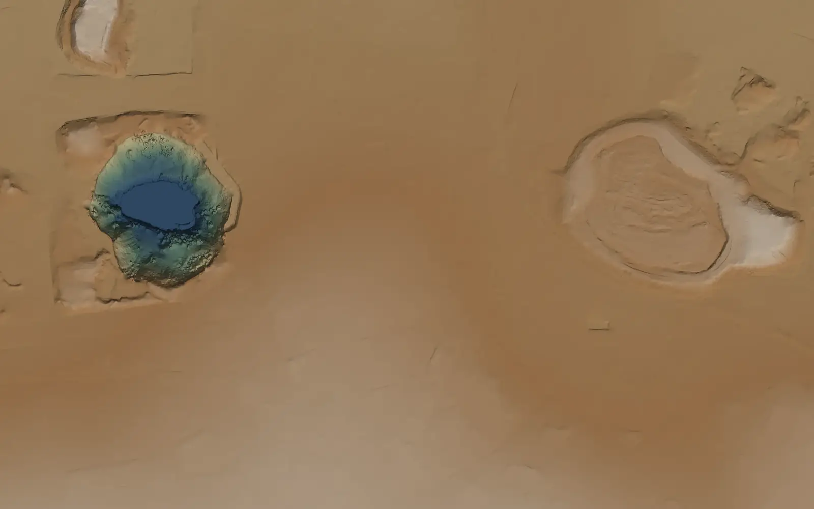
The terrain model keeps pit walls and dumps
Every stereo order includes a 0.5 m surface model, terrain model and height above ground. Measure stockpiles on the surface model.
- NMAD against ICESat-2, on passes held out of the fit
- 0.18 m
- NMAD against ICESat-2, on passes held out of the fit
- ICESat-2 ground measurements in the check
- 80,050
- ICESat-2 ground measurements in the check
- grid for the surface and terrain models
- 0.5 m
- grid for the surface and terrain models
- in the price of every stereo order
- Included
- in the price of every stereo order
Kimberley, Northern Cape, South Africa.
Radar tracks movement through the wet season
InSAR compares repeat radar passes to show how far walls, dumps and dams moved toward or away from the satellite.
Each job is scoped with you. We check the radar archive first and say whether new passes are needed.
works through cloud and at night · KOMPSAT-5 archive and tasking
Shortwave infrared finds alteration minerals
Clay and carbonate alteration minerals show absorption features in the shortwave infrared.
- WorldView-3 · 8 SWIR bands at 3.7 m
- A$40/km² archive · A$105/km² new
A 2025 case study: alteration mapping with WorldView-3 SWIR →
Send us the tenement boundaries
Add your reporting date. We'll say what the archive holds, what needs a new capture, and the price.
Samples over your own site are by application. Licensing, invoicing and security are on the enterprise page.